History
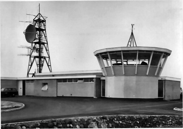
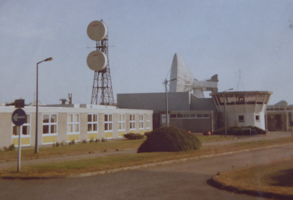
The Earth Station at Goonhilly entered service in July 1962, requiring an SHF link to connect to the trunk network. Initially this was on a temporary basis but a link tower was built near to the control room at the centre of the site. One complication was the shared use of 4 and 6 GHz bands for "inland" links and satellite communications - this is one of the reasons for the choice of site, to the west of the existing SHF network. We understand GEC provided a one-way 2 GHz link towards Plymouth with the return path at 7 GHz. An article in the Post Office Telecommunications Journal, Winter 1965 summarised the provision at that stage: "...a coaxial cable from London to Bristol, an unprotected microwave radio channel between Bristol and Plymouth and three "hops" of gap-filling, transportable radio equipment between Plymouth and Goonhilly [...provided at short notice...]". Unsurprisingly, this could not "...answer the needs in performance and reliability for a permanent system, particularly one associated with international circuits." STC was contracted to provide a link between Goonhilly and Plymouth, the first to use the "Upper" 6 GHz band. Initially this was to be one working and one protection channel in each direction, to be in-service by the end of 1966. Improvements would be made over the other sections of the route as part of a wider programme.
The 1966 link ran via two sites at Mount Stamper and Burydown. The structures may have been in place for the interim 1962 arrangements and appear to have been designed to accept horn antennas although none were ever fitted. The capacity of SHF route between Goonhilly and London was constrained by telephony and televsion links over the section east of Bristol but cable routes were also available. In the 1970s a new SHF route became operational along the north coast of Cornwall - this may have been used for some Goonhilly traffic (via Carnemenellis) but did not address the bottleneck between Bristol and London. 1980s plans, however, suggest this would become the primary connection for Goonhilly with the original route truncated to Burydown. Cable (including fibre) links were available from St Austell and it is impossible to determine what proportion of traffic went via SHF. Goonhilly and the satellites also had limits on capacity but there is little information about the maximum number of voice calls or television links which could be carried simultaneously.
BT operations at Goonhilly ceased in 2008 and by this time the remaining SHF links were being migrated to fibre. Whilst there are many photos of the large satellite dishes there are very few showing the SHF link tower or other aspects of the site.
An article in the Post Office Electrical Engineers' Journal, October 1962, describes the use of a test source at Leswidden (the site now known as St Just). The text also notes: "To reduce the design time for the central building, one of a range of standard buildings used by the Ministry of Works for the microwave link stations was selected."