History
Five Ways appears as "Box" on the original 1956 Backbone map, as a baseband telephony connection point at the end of a "standby" route towards London. The 1959 Network Map refines this location to "Corsham" and shows links - at that point "programmed" - to sites labelled "Mendips" (East Harptree) and Wotton-under-Edge. By this time another route was already "existing or under construction" from "Bristol" (Purdown) via "Mendips" towards Exeter and Plymouth, and with a "programmed" link to Wotton-under-Edge. This seems to fit with the general "Backbone" concept - traffic was routed away from Bristol but shared other sites where possible.
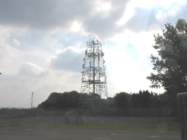
The Subterranea Britannica feature The Towers of Backbone notes that the tower was truncated during the late 1980s. A TV-AM report from March 1984 (video - see 1:57 onwards) shows the tower still at full-height and carrying two horns - and evidently no other antennas. The remaining structure still has traces of its earlier use but the site does not appear to have been used in the "core" BT network from the 1980s onwards. There is, however, a repeater station nearby - part of the PO cable network - and archive documents suggest there was a cable from Corsham direct to the SHF site at Wotton-under-Edge.
The presence of the tower, and its later near-abandonment, does seem to tie in with the need for communication links to the formerly classified MOD and other Government facilities in or around Corsham and their subsequent run-down and closure. Documents now released by the National Archives show "Backbone" offered relatively limited bandwidth: between Stokenchurch and Fiveways there were 8 "Supergroups" (each 60 circuits). The equipment available in the early 1960s was able to carry this number of circuits on a single SHF channel.
The site name was perhaps deliberately cryptic and seems to have been derived from the local name given to the five-way junction, immediately north of the site, between the B3109 and local roads.
Photos
1963
A Ministry of Works Photo available at Historic England shows the newly completed building but no antennas had been installed as of September 1963.1971
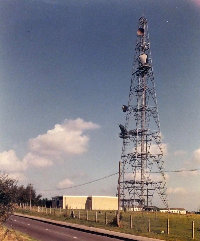
Copyright BT Heritage [TCB417/E 56269]
The "small" horn antenna was capable of operation on 4 GHz or 6 GHz therefore the dishes suggest the 2 GHz band was also used at some stage.