History
The Historic Scotland "Canmore" archive lists a number of photos of Portmahomack - indexed as "Easter Bindal" - from around 1974 (images not available on-line). These relate to the construction of the building and tower, with the site appearing on a 1976 OS plan. Together with Helmsdale, Portmahomack formed part of a new link towards Thrumster, replacing the 1950s route from Braewynner. The timing coincided with the development of off-shore troposcatter communications which required an "inland" link between sites at Scousburgh and Mormond Hill.
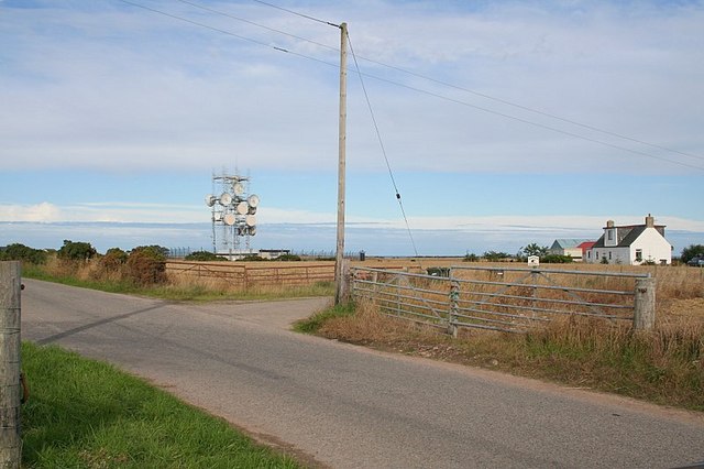
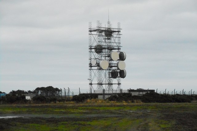
A "Type 5A" tower was provided, two modules across and with the wide faces aligned to favour Helmsdale and Daviot. Conveniently this puts one of the narrow faces towards Tor Sliasg which seems to have been an equally important route. The route via Daviot was extended during the 1980s but appears to have been a branch serving Inverness initially.
Recent photos show large dishes still facing in all three directions however Ofcom data suggests there is now no active route via Tor Sliasg. The main north/south links however may be still operational, along with a number of local 18 GHz links.