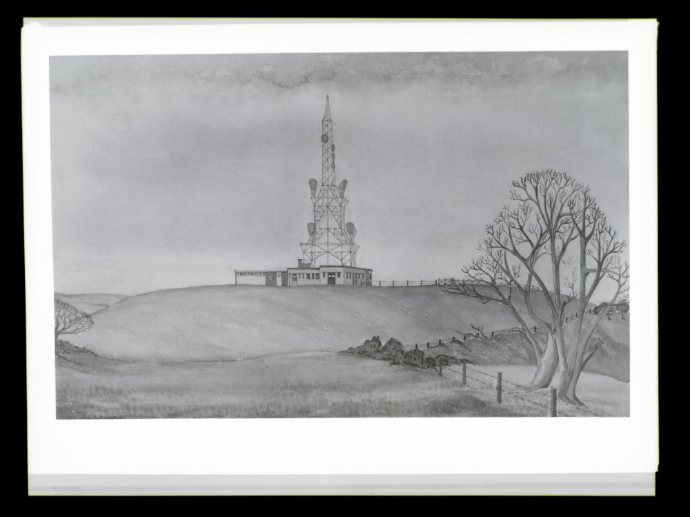
History
Butser Hill is an early example of a "takover site" - by the early 1960s the site was used for a microwave
link between the radar station at Ventnor and the London Air Traffic Control (Heathrow, later West Drayton).
This was itself appears to be successor to an earlier facility as documents in the CPRE archive suggest a
"mast" was present by the early 1950s. A T-shaped building appears on the 1962 OS
map, just west of the Post Office site. BT Archives has a sketch (see below) showing a version of the "standard
tower" and an unusually large building. In practice a one-off tower design was adopted - a triangular structure
constructed from steel tube. Some features are similar to the much later "Type 8A" tower. It appears the intention
was to consolidate all dishes onto the Post Office structure and remove the existing tower(s). Photos
showing progress as of 1965 show at least two other structures with one dish for the radar link mounted on
the roof of the existing building.
The "new" tower was designed primarily to carry two horns (of the "large" type) facing Bagshot and another
two ("small") facing Thornhill, forming part of a new route between London and Southampton. The initial traffic
was television feeds, replacing the earlier link via Golden Pot. The new route would be to 625-line colour standard. Provision was
also made for one dish facing Ventnor and another to Stone Hill (near Farnham) for the radar link. Due to delays
at Bagshot a temporary link via Golden Pot and Stokenchurch was provided to allow BBC2 to
launch from the Rowridge transmitter in July 1967. The OS plan dated 1967-70 shows the new tower and two others
labelled "wireless mast" which are assumed to be those in the 1965 and 1967 photos below. These structures were
dismantled on final completion of the new Post Office arrangements.
Traffic to Southampton was constrained as the section between London and Bagshot was shared with the
Bristol route. The 1984 photo shows the addition of two dishes, of 1970s style, plus the exchange of one
large horn for a dish, but there is no evidence of dishes for digital links or the use of a new route which
which was planned at the time to run via Goodwood. Planning objections to the Goodwood site may mean the
new link was eventually equipped on a limited basis or not introduced at all. By 1999 only the two 70s-style
dishes remained - which perhaps confirms the 1980s plans were not completed.
Photos
1962
Copyright BT Heritage [TCB417/E 27956]
Initial plans were for a "Standard Tower" - the building appears to be a combination of existing and new
(left hand section) but in practice the two buildings were separated, with the tower between.
1965
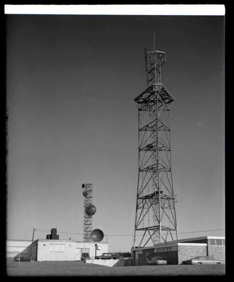
Copyright BT Heritage [TCB417/E 31489]
Viewed from the south, the "partially completed" tower - although it appears essentially finished in this November 1965 image.
The new Post Office building is on the right. On the left one dish for the radar link is mounted on the roof of the original
building and the other is on what appears to be a temporary structure. There are also two smaller dishes, probably for the
temporary BBC2 link running between Golden Pot to Thornhill.
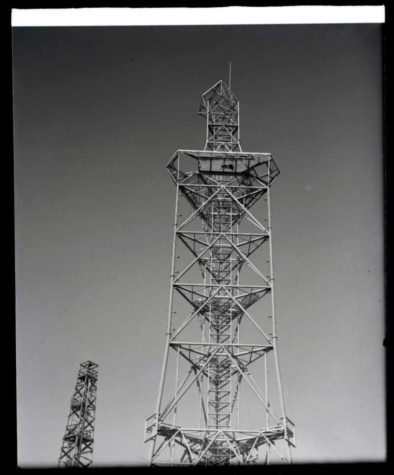
Copyright BT Heritage [TCB417/E 31491]
Assumed from the south east: an older "Air Ministry" type tower is visible in the background. The mountings for the radar
link dishes are at the bottom of the image, on the corners of the main structure, facing Ventnor (left) and Stone Hill (right).
1967
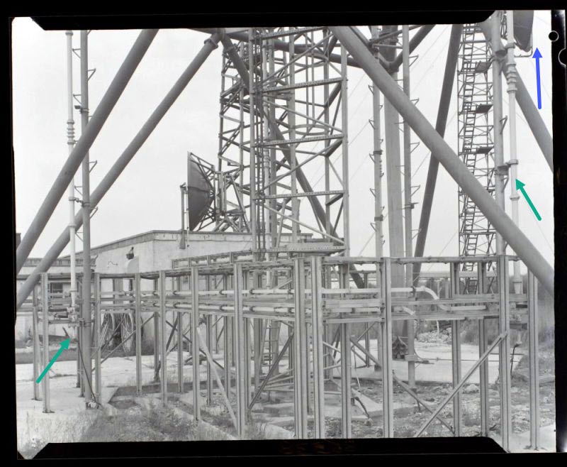
Copyright BT Heritage [TCB417/E 35338]
A detailed view of the base - the two other towers are still in place, with the dish facing Ventnor still
on the roof of the building. To the left and right are sections of circular waveguide used with the horn
antennas (green arrows) with the connection to the horizontal waveguide just visible at the base. Two other
waveguide supports are visible towards the right hand side with a main "leg" behind. This is a "busy" photo
since we can also see the first horizontal level and the tubular bracing struts, together with the inner
triangular lattice structure. The dish in the top right hand corner (blue arrow) is still on the temporary
tower behind.
1971
Copyright BT Heritage [TCB417/E 56613]
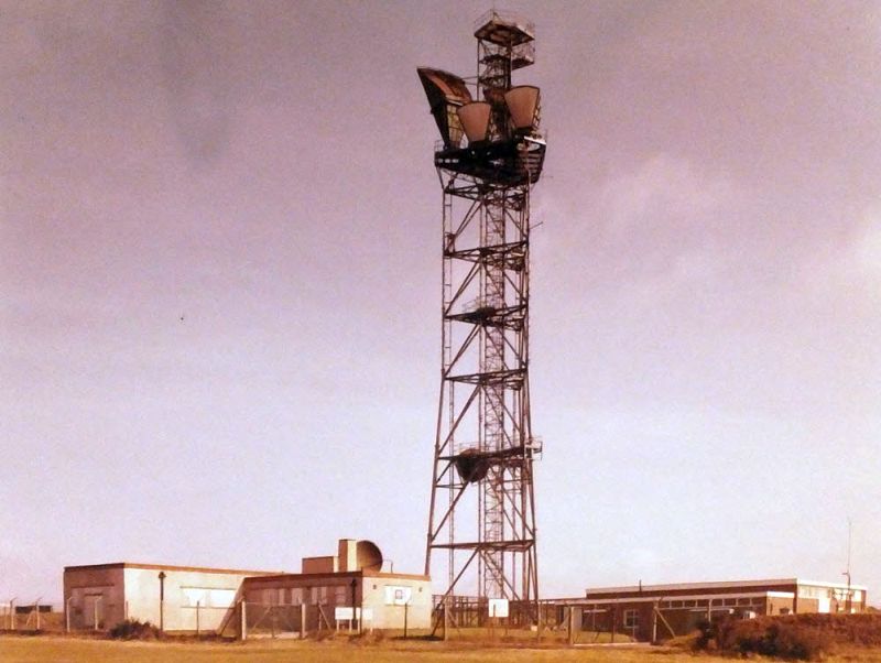
The tower now carries the intended configuration of four horns for the Post Office but one of the radar
link dishes has remained in place on the roof of the original building. The platform above the tower
may have been designed to accept a further horn antenna.
1984
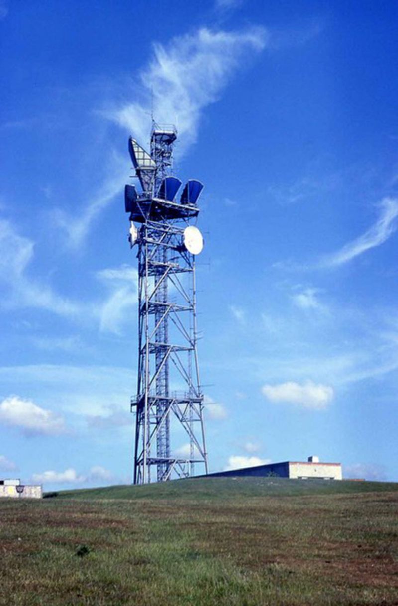
Copyright Barry Shimmon (Geograph)
Viewed from the north west. One of the horns facing Bagshot has given way to a dish there are dishes
of 1970s style facing Bagsgot and Thornhill. The radar dish has been removed, leaving an empty mounting on the left.
The development of "plot extraction" allowed low bandwidth links to be used for remote radar sites by this stage.
There is no trace of any new link towards Goodwood (although this would be on the opposite side of the tower) and
no dishes of 1980s design facing Thornhill - this appears to confirm no digital links had been installed at this
stage.
1999
Copyright Patrick Gueulle (Geograph)
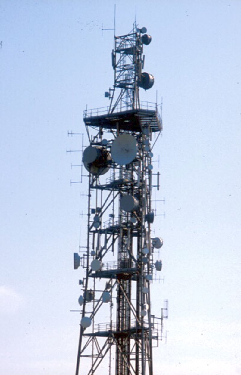
Assumed to be from the south. The top of the structure has been modified. The two older dishes remain
but the horns and large dish attached to the top platform have been removed, suggesting "recovery"
rather than "renewal". It is possible digital links were installed after 1984 and already removed but
this seems unlikely.
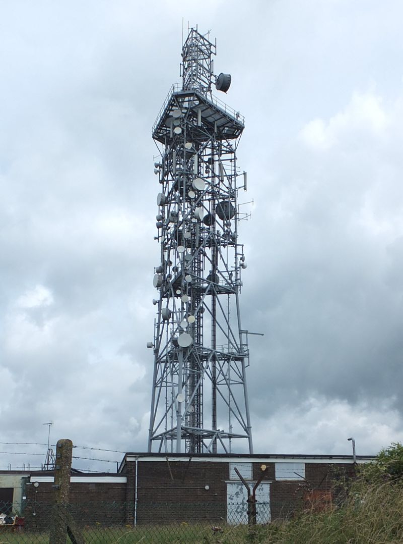
2016
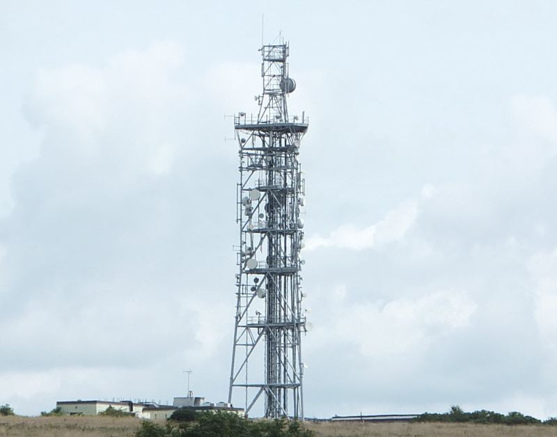
Copyright Dan Glover
By this point the trunk network had ceased but it is interesting to compare with the images from the
1960s...
Copyright Dan Glover
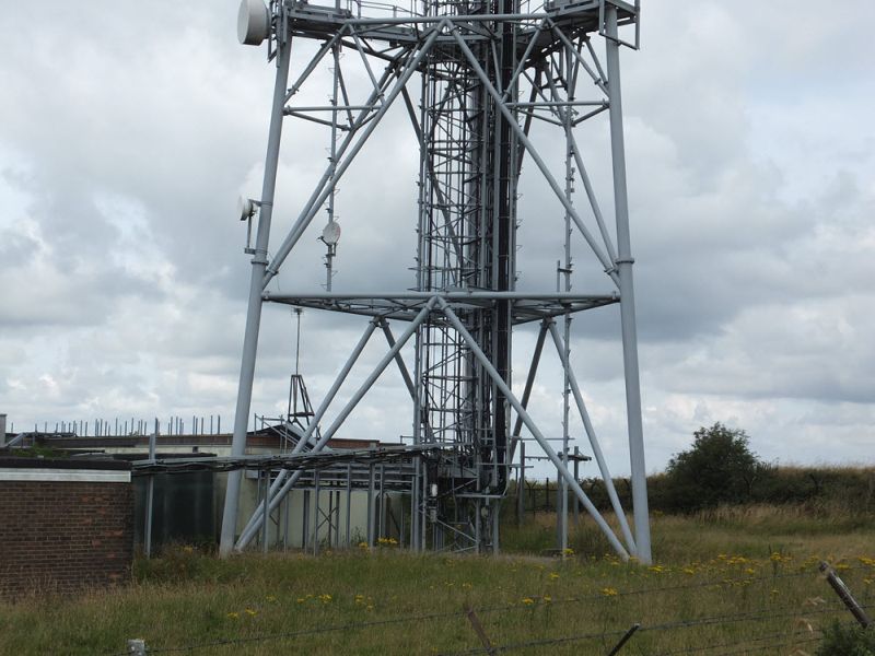
Copyright Dan Glover
...the support for the radar link dish has remained in place on the roof!