History
Muggleswick featured on the 1956 Backbone map as a major node which was to be a "Baseband Connection Point" for both telephony and television. As well as the main north/south route there were to be "standby" links to Seaton Snook and Alnwick (for Boulmer).
The reality appears not to have matched with plans to any great extent. The Backbone route was diverted to use existing sites at Corbys Crags and Arncliffe Wood - originally established for the Manchester to Kirk o'Shotts TV link. The 1951 TV route was subsequently upgraded and the nearby site at Pontop Pike received two new towers by the late 1960s. In contrast Muggleswick appears never to have progressed beyond a 230 ft stayed mast although a permanent building of the standard pattern was provided. Boulmer was, in due course, connected to the Post Office network via Corbys Crags.
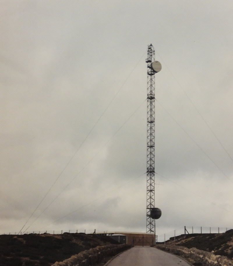
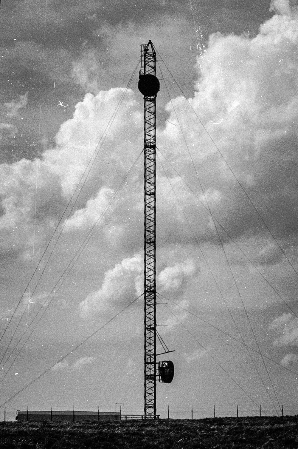
There is very little historical information available for Muggleswick. It presumably existed only because Pontop Pike was too close to a built up area (Newcastle) to be acceptable as part of Backbone. A curious photo in the Ministry of Public Works archives is dated 1959 and shows a tower of an unusual style with quite strange antennas - however this could well be a photomontage to illustrate how the site might appear. The contract for the Backbone route from Craigowl to Hunters Stones was not placed until 1960, according to the Engineer in Chief's report for the year ending 31 March 1961. The report further states: "[this link] will operate in the 5925-6425 Mc/s band, using aerials of the horn reflector type". By 1975 the mast carried two dishes of relatively modern style. It's not clear whether the structure had previously supported horns - it seems unlikely - but it also seems unlikely a tower would have been replaced by a mast.
Having opened specifically for Backbone, the site seems to have been unsuitable for further use when Backbone closed in 1989. Unfortunately the redundant mast, or more exactly one of the stay cables, was involved in an air accident in April 1992, resulting in the destruction of a light aircraft and loss of the pilot's life. The photos in the AAIB report show the mast apparently empty at the time and since one of the stay cables was severed during the collision it is likely the structure would have been dismantled soon after. In 1998 two planning applications for mobile phone installations of just 15 m height were refused on the grounds of their visual impact. The documents refer to the site's previous history but the planning authorities took the view that once the station had been dismantled the previous permission was revoked. (An application in 2002 was approved).
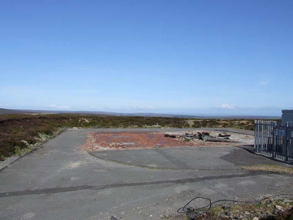
Aerial photographs show the current installation in one corner of a large compound with the original stay blocks visible beyond. In the centre is an area of disturbed ground where the PO building stood.